
The Port of Tacoma has three major business areas: container shipping terminals, breakbulk and bulk terminals, and real estate. Port projects are designed to create new economic opportunities in these business areas, preserve and enhance our natural environment, and to maintain our facilities and infrastructure.
Port projects in planning and design
Alexander Avenue Former Tank Facilities

The revised draft final feasibility study (FS) was submitted to Ecology in November 2020. The draft cleanup action plan (DCAP) will begin upon Ecology approval of the final FS. Preliminary cost recovery research has begun. The Agreed Order includes the Port and Mariana Properties, a subsidiary of Occidental Chemical Corporation.
The project scope includes completing an RI/FS for the site, assisting Ecology in preparing a cleanup action plan, and reimbursing Ecology for their oversight costs. Additional scope for preliminary cost recovery efforts was authorized by Commission in December 2018.
Arkema 2901 & 2920 Taylor Way

A draft cleanup action alternative document was submitted to Ecology in order to establish the technical framework of remedial alternatives to be evaluated in a feasibility study (FS). The draft FS is scheduled for completion in early 2021. The final FS and draft Cleanup Action Plan (DCAP) will be submitted to Ecology during late 2021.
Looking forward, the scope of this effort is anticipated to include:
- Technology Screening and Alternative Evaluation
- Interim Action(s)
- FS Reporting
- Draft Cleanup Action Plan
Blair Waterway Berth Maintenance Dredge Project

This project will remove or “dredge” underwater sediment at Washington United Terminals and Husky Terminal so that they can serve the increasingly larger cargo ships that dominate global trade. Each terminal has what is essentially an in-water parking space for a vessel known as a berth.
Over the last few years, the current of water created by vessel propellers or “prop wash” have caused sediments to build up, shallowing up the area where ships tie up to dock.
Because a vessel will sit higher or lower in the water depending on the size of the ship and the weight of its cargo, the depth of a berth can be a limiting factor in how much cargo can be loaded on a ship. Since many of our exports are heavy agricultural products, maintaining the depth of these berths is critical to maximizing cargo stowage and space utilization on vessels.
The project will remove high spots that have appeared at the terminal berths, restoring them to their authorized depth of -51 feet MLLW. This depth is critical to maintaining the competitiveness of the gateway.
These berths are overdue for maintenance dredging. Last maintenance dredging was performed about 12 years ago.
This project is not related to the U.S. Army Corps of Engineers/Port of Tacoma’s Tacoma Harbor Navigation Improvement Study/Blair Waterway Deepening Project, which proposes to deepen the federal channel in the Blair Waterway to -57 feet mean lower low water.
Blair Waterway Deepening Program (Federal Channel)

To remain competitive in the shipping industry, the Port of Tacoma and The Northwest Seaport Alliance (NWSA) have made major investments, including improving docks and purchasing larger cranes. The next phase of this effort is to deepen the Blair Waterway to accommodate larger container ships. The project will deepen the federal channel in the Blair Waterway by six feet, to -57 feet mean lower low water (MLLW).
East Commencement Habitat Opportunity (ECHO)
Since the early 2000s, the Port has been looking to build a mitigation and restoration site in eastern Commencement Bay. This 20-plus acre site is one of the last best places in the bay for nearshore restoration.
The Port is working with the U.S. Army Corps of Engineers to study the feasibility of using clean dredge material from the Blair Waterway Deepening Program to create the East Commencement Habitat Opportunity (ECHO) site.
Former USG Rock Wool Plant - 2301 Taylor Way

The 2301 Taylor Way property is subject to an Ecology order requiring the development of a remedial investigation, feasibility study (RI/FS) and cleanup action plan (CAP). A former owner is leading the effort, as provided for in a purchase and sale agreement. The RI has been approved, and work is underway to select future cleanup actions under the FS.
A related issue (not associated with this authorization) is the USG-related contamination that has migrated onto adjacent Port-owned property (North Boundary of the Arkema Manufacturing Area). USG denies responsibility for contamination beyond the 2301 Taylor Way boundary.
During Q3 2020, Ecology and Office of Attorney General staff agreed that remediation of the USG related contamination that has migrated onto adjacent Port-owned property should be performed under the USG Order. A feasibility study for this work is under development and will be submitted to Ecology in early 2021.
The scope of work includes:
- Technical review of ongoing USG deliverables
- Legal support
- Allocation report
- Staff time & consultant support
- Consultations with Department of Ecology
Lower Wapato Creek Habitat

The Lower Wapato Creek Habitat (LWCH) property was previously filled with dredged materials and currently contains high densities of invasive and noxious weed species. The proposed design will reestablish a portion of the creek channel and associated features to as close to the historic creek location as possible.
This is a habitat improvement project to restore Wapato Creek with a diverse mosaic of interconnected estuary, emergent, and forested wetlands and riparian habitat as advance mitigation for future Port projects. In total, the project is anticipated to create 18.52 acres of habitat in close proximity to a number of other habitat restoration sites along Wapato Creek. This will support efforts by the Port and the Puyallup Tribe of Indians to improve fisheries in the area.
Another component of the LWCH project is to remove an existing partial fish passage barrier (two 60-inch perched culverts) and install a full-span bridge at the 12th Street East crossing to provide unimpeded fish access and habitat connectivity upstream of the project, improve flood conveyance, and restore natural stream processes such as sediment movement.
Habitat site and Bridge permit documents have been submitted to all agencies for approval. All permits are anticipated by March 2021. Bidding is planned for April and construction should be underway in May 2021.
Parcel 1B (Earley Business Center) Cleanup
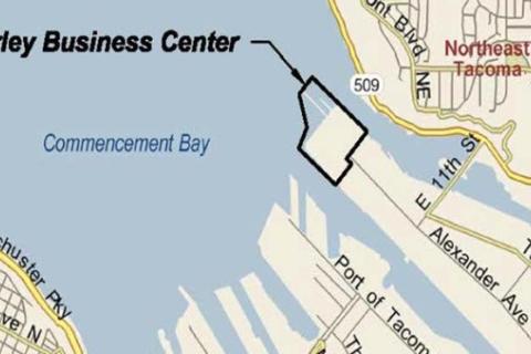
The Port and Ecology entered an agreed order (Order) for completion of a remedial investigation (RI), feasibility study (FS), and draft cleanup action plan (DCAP) in 2013.
In 2017, Ecology provided written notice that the provisions of the Order had been met.
In 2019, the Port received an informal request to supplement the RI, followed shortly by a formal notification that Ecology is rescinding their prior approval of the Order.
The Port project team met with Ecology in October 2020 to discuss both parties’ concerns and potential resolution pathways. Ecology requested supplemental information from the RI, which the Port provided. Ecology is currently reviewing the material and the two parties will meet again when their review is complete.
Reach a compromise with Ecology on a path forward. Develop supplemental figures and technical information as needed. The scope of work for remedial design includes:
- Prepare bid documents
- Obtain appropriate permits
- Prepare Engineering Design Report for Ecology
The scope of work for cost recovery includes:
- Generate claim summaries for each of the three defendants.
- Prepare for non-binding mediation to attempt settlement of claims.
Parcel 15 (Portac) Cleanup Investigation

The site is about 52 acres located at 4215 E Frontage Rd. (State Route 509) next to Wapato Creek in the Tacoma Tideflats. From 1974 to 2009, Portac Inc. leased the property from the Port. The property was a log yard and a sawmill. In 2008, Portac Inc. removed the sawmill. Now the site is a paved parking lot for cars and trucks.
A draft addendum to the feasibility study (FS) was submitted to Ecology in October 2018, with the final accepted by Ecology in February 2019. A draft cleanup action plan was submitted to Ecology in July 2019, with some back and forth on revisions.
The revised draft cleanup action plan was submitted to Ecology in June 2020 and approved in July 2020. Multiple drafts of the agreed order (AO) were exchanged between June and December 2020, with the final now ready for Commission approval.
The schedule completion date has been adjusted from Dec. 31, 2020, to June 30, 2021.
The Port secured $500,000 in MTCA grant funding and received $500,000 in reimbursements to date. In the 2020, supplement legislative budget of $1 million in MTCA grant funding was awarded for the 2019-2021 biennium. Grant agreement negotiations with Ecology are underway. These grants are through Ecology’s Remedial Action Grant program and are matched 1:1 by Port dollars.
The comment period fact sheet provides a brief summary about the history and proposed cleanup work at the Site.
Parcel 91 Cleanup Investigation & Cost Recovery

The demolition of a 117,000-square-foot PCB-contaminated building was completed in 2015, but residual chlorinated VOCs (volatile organic compounds) remain in soil and groundwater on the property.
The site has been withdrawn from Ecology’s Voluntary Cleanup Program, and the Port has requested entry into an agreed order (AO) to complete the feasibility study (FS) and draft cleanup plan (DCAP). Ecology assigned a project manager in mid-2020.
AO negotiations with Ecology to complete a feasibility study and draft cleanup action plan are now anticipated to be completed by the end of Q1 2021.
Grant funding will be pursued as opportunities arise. Pfizer’s settlement of $1.5 million and Sound Mattress’ settlement of $3.4 million were both received in July 2018
Parcel 103 Steam Plant Property Cleanup

Port staff and Tacoma Power will co-select an environmental consultant in Q1 2021 to recommence the cleanup investigation. The project is not eligible for Ecology’s Voluntary Cleanup Program (VCP), and Ecology is not open to an Agreed Order at this time. The Port and Tacoma Power will move forward with the investigation
The scope of work will include completion of the remedial investigation and feasibility study (RI/FS), and a draft cleanup action plan (DCAP). As mentioned above, the cleanup will not be implemented without Ecology supervision. The schedule completion date (through implementation of the cleanup) has been adjusted from Dec. 31, 2022 to Dec. 31, 2025.
Port Maritime Center

The Port Maritime Center will be a landmark campus on the Tacoma waterfront, home to a new Port of Tacoma business office building and Tacoma Public Schools’ new Maritime|253 skills center. The proposed location is on the east side of the Foss Waterway, just south of the Murray Morgan Bridge (11th Street Bridge). Maritime|253 will provide opportunities for high school students across Pierce County and help develop a future maritime workforce.
Find out more on the Port Maritime Center project page.
Puget Sound Energy LNG Facility

Puget Sound Energy is building a liquefied natural gas (LNG) facility at the Port of Tacoma.
The facility will provide local transportation companies, including TOTE Maritime Alaska vessels, with a cleaner fuel alternative. It also will provide residential and commercial customers with natural gas reserves to maintain dependable service on the coldest days of the year.
Here is a list of required permits and their status. Some people have alleged that PSE is building without permits and have pointed to Puget Sound Clean Air Agency’s Notice of Violation. While that is untrue, here is the correspondence related to the NOV. Other information is available on PSCAA’s project website.
PQ Contamination - 1201 Taylor Way

PQ entered into the Interim Cost Sharing Agreement on March 17, 2016, to complete a remedial investigation, feasibility study (RI/FS) and draft Cleanup Action Plan (CAP). The RI/FS and CAP was submitted to Ecology in July 2020.
The revisions to RI/FS and CAP are expected to be submitted to Ecology in Q3 of 2021. Remediation is expected to occur during 2021 or later.
Looking forward, the scope of this effort consists of:
- PQ and the Port will collaborate in the completion of the RI/FS and CAP
- PQ will pay 60% and the Port will pay 40% of future shared costs
Remediation is expected to occur during 2021 or later. It will also be necessary to amend or renegotiate terms of the Cost Sharing Agreement to offset remediation costs to be incurred by the Port. The schedule completion date has been adjusted from Dec. 31, 2020 to Dec. 31, 2021.
Scope of work is subject to change depending on direction from Washington State Department of Ecology. Monies received from PQ are potentially subject to reallocation under the agreement.
T3, T4 (Husky) Shore Power
Following industry data gathering efforts, project team has recommended an increase in shore power system capacity to adequately serve anticipated vessel power needs. Project: US CBP Booth Installations – Washington United Terminals
The scope of this project is to design, construct, test, and commission two shore power systems at Terminal 3 and Terminal 4 including:
- Installation of electrical equipment, vaults and concrete equipment foundations
- Wharf modifications to provide ship-to-shore power connections
- Trenching for new conduit in select areas
- Cable pulling through new and existing conduit
Taylor Way & Alexander Avenue Fill Area (TWAAFA)

Planning on this site supports marketing efforts for a 30.48-acre multiparcel property (Port Parcels 6, 65, 102, 114, 116, and 117) for redevelopment. This project also stemmed from Ecology requirements to investigate Parcels 95, 111, and 117 for hazardous substances in soil and groundwater under an agreed order with three other Potentially Liable Parties (PLPs) (General Metals of Tacoma, Occidental Chemical Corporation, and Stericycle Environmental Solutions).
The Port rejected the TWAAFA (Taylor Way and Alexander Avenue Fill Area) agreed order because there is no compelling legal basis for the Port to investigate and remediate an abandoned dangerous waste facility and illegal landfill to which the Port has no connection. Ecology responded with a proposed enforcement order on October 6, 2020, and subsequently issued an enforcement order to the Port on December 7 for public comment until Jan. 5, 2021.
The scope of work for this project includes:
- Facilitate execution of a long-term lease agreement.
- Negotiate and execute a Joint defense, common interest agreement and cost sharing agreement for pre-agreed order actions between the Port, General Metals of Tacoma (GMT), Occidental Chemical Company (Occidental) and Stericycle Environmental Solutions (Stericycle).
- Negotiate an Agreed Order between Ecology, the Port, GMT, Occidental, and Stericycle to prepare a remedial investigation/feasibility study (RI/FS) and draft cleanup action plan (DCAP).
- Complete a Pre-Agreed Order Data Gaps Work Plan (Work Plan).
- Implementation of Work Plan portions relevant to Parcel 117 during 2019 and 2020.
Off-Dock Container Support Facility

The Port is in the process of developing a new Off-Dock Container Support Facility on three Port-owned parcels (total of 24.5 acres) east of Thorne Road and north of Maxwell Way in the Tideflats.
Port projects under construction
Head of Hylebos Cleanup
Sediment PCB concentrations, while elevated compared with the 2006 results, are declining compared with the 2012 results.
In the draft 2019 5-year review, the U.S. Environmental Protection Agency has acknowledged the increased sediment PCB concentrations and that these conditions may be indicative of an ongoing source to the waterway
The EPA still requires an Operations Maintenance and Monitoring Plan (OMMP) to close out this construction MID. The OMMP was drafted and submitted to the EPA in 2020. The EPA provided comments and the OMMP is being revised. The OMMP will dictate future sediment sampling requirements in the head of the Hylebos.
Marshall Avenue Auto Facility Pavement Maintenance
Project bid documents for annual pavement maintenance (surface sealing) were completed and ready to post for public bidding. Due to COVID-19 budgetary constraints, engineering was directed to put the project on hold until 2021.Project: Blair Terminal Fender System Upgrades.
The scope of work for this project includes:
- Surface sealing: 10 to 12 acres on an annual basis, 50 to 60 acres total (estimated)
- Crack sealing: 10 to 12-acre area on an annual basis, 50 to 60-acre area total (estimated)
- 5 years of annual maintenance cycles
Pierce County Terminal Operational Pavement Repairs
Pavement repairs will continue to be made as areas requiring repairs are identified. Significant areas in and around the truck transfer zone, the reefer storage area and within the yard were completed in 2019. Additional areas in and around the truck transfer zone, the reefer storage area and within the yard were completed in 2020.
Complete repairs to the failing pavement sections at Pierce County Terminal from 2018-2022.
TOTE (Parcel 1A) Roof Replacement
The canopy structures at the north inbound gate at TOTE (parcel 1A) were originally constructed in the early 1980s.This project will remove the existing metal roofing and replace it with new coated metal roofing, s new fall protection, and bird deterrent systems.
Wapato Creek Bridge and Culvert Removal
This project replaces a failing, undersized culvert with a bridge to provide continued access to the Pierce County Terminal truck queuing area. It will further enhance our Lower Wapato Creek Habitat Project, located just upstream, by improving tidal flow, water quality and fish passage. It will also reduce the potential for upstream flooding during periods of high tide/flow, decreasing the risk of flood damage to critical upstream infrastructure when the fish-friendly habitat site is completed. The new bridge has been constructed in part thanks to funding from the Pierce County Flood Control Zone District.
Washington United Terminals Fender System Replacement
The objective of this project is asset preservation in accordance with The Northwest Seaport Alliance (NWSA) lease obligation to repair and/or replace the fender system at Washington United Terminals. The original pier fender-pile system is not performing well with modern large vessels.
The existing fender-pile system energy capacity and stiffness are not high enough to handle modern vessels. The fenders need to be replaced with a system that can handle and withstand the size of vessels calling at Washington United Terminals.
Washington United Terminals Utility Vault Upgrades
This project will repair and upgrade vaults at Washington United Terminals that have been damaged because of uneven ground settling. It will install new vault castings within a reinforced concrete collar to eliminate the settlement issues around the vaults, preventing future damage and improving yard operations.