
Environmental stewardship
The Port is committed to responsible, sustainable growth. As stewards of our environment, the Port restores and protects habitat for salmon and wildlife. The Port has constructed, preserved, or participated in 21 sites, totaling over 213 acres.
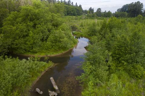
Habitat restoration story map
Habitat sites
Gog-le-hi-te Wetland Complex (13.5 acres)

Gog-le-hi-te is currently comprised of three different restoration actions: Gog-le-hi-te I, II, and Habitat Improvement Action (HIA). Gog-le-hi-te I is the Port’s oldest habitat restoration site, constructed in 1986. The Puyallup River levee was breached in two locations for Gog-le-hi-te I and II. The breaches create essential off-channel estuary habitat for migrating salmon.
Slip 5 Habitat Site (7 acres)

The Slip 5 Habitat Site is located at the mouth of the Blair Waterway, at the north end of the General Central Peninsula. It consists of valuable intertidal and shallow subtidal habitat protected from high-energy waves by a reef-like berm. Slip 5 provides important rearing and foraging habitat to juvenile salmon upon their emergence from the Puyallup River, as well as foraging opportunities for shorebirds and waterfowl.
Mowitch NRDA (3 acres)
Mowitch consists of three backwater pools and a permanent 100-foot vegetated buffer along the shoreline where Hylebos Creek transitions into the Hylebos Waterway. The backwater pools provide a calm foraging and rearing area for juvenile salmon as they transition from freshwater to saltwater. The plants in the buffer provide feeding, nesting and cover for both resident and migratory wildlife species. The site has been deeded to the City and is under the care of the Natural Resource Damage Assessment (NRDA) Trustees.
Milwaukee Waterway (30 acres)

The Milwaukee Waterway is comprised of two different environmental actions. The inner two-thirds of the former waterway were filled with contaminated and clean dredge material as part of a clean-up action associated with the Superfund program. The outer one-third of the waterway was shaped into 21 acres of marine intertidal sandflat and mudflat habitat, with the remaining nine acres of intertidal and shallow subtidal sandflat and mudflat habitat extending beyond the waterway. This habitat site is one of the first protected marine areas available to migrating salmon as they leave the Puyallup River and enter into Commencement Bay. It provides surf smelt spawning habitat, as well as foraging opportunities for salmon, shorebirds and waterfowl.
Outer Hylebos (~1.5 acres)
The Outer Hylebos was originally designed and constructed by the Puyallup Tribe of Indians on Port of Tacoma property. Ownership of the site was transferred from the Port to the Puyallup Tribe of Indians as part of the Puyallup Land Transfer Consent Decree. The EPA requested the Port re-mitigate the site under the claim that the site did not provide the habitat that was presented in the original mitigation plan. As part of the agreement between the Port, the Puyallup Tribe of Indians, and the EPA, intertidal and salt marsh wetlands were restored, enhanced and upland riparian vegetation was installed and enhanced. The Puyallup Tribe of Indians is the owner of the site and is responsible for the maintenance and monitoring of the site; however, the Port is liable for any additional mitigation if the site does not meet mitigation objectives and/or performance standards.
Fairliner (~3.5 acres)
The Fairliner habitat site is located along the Blair Waterway, at the site of the former Fairliner Marina. The floating pier structures, access ramps, and boat houses associated with the marina were all removed, and the site was filled with clean sediment and gravel to create intertidal and shallow subtidal habitat at elevations similar to the historic conditions in Commencement Bay. Fairliner provides habitat for juvenile salmon and waterfowl and has a densely planted upland area with native trees and shrubs.
q(w)iq(w)ǝlut (Little Marsh) (~1.5 acres)

Formerly known as Rhone-Poulenc, qwiqwǝlut is the site of a former fertilizer plant. The intertidal mudflat and salt marsh provide habitat to migrating juvenile salmon and waterfowl. The Port deeded the site to the City of Tacoma after construction and it features a public overlook with views of the habitat site and the Blair Waterway.
Clear Creek (~16 acres)

Clear Creek is the last freshwater refuge for juvenile salmonids before the Salish Sea’s tidal influence introduces saltwater into the Puyallup River system. The Port constructed the Clear Creek habitat site to provide off-channel rearing and foraging opportunities for migrating salmon before they enter Commencement Bay. The Port’s Clear Creek habitat site is comprised of two different phases. The first phase included removing abandoned buildings, cleaning up debris, installing a sluice gate at the confluence of Clear Creek and the Puyallup River, creating tidally-influenced, freshwater off-channel habitat, and planting native shrubs and trees. Phase II of the Clear Creek habitat site included another 6.5 acres of tidally-influenced, freshwater habitat, as well as additional native tree and shrub plantings. Together, the two phases generate ample opportunity for juvenile salmonids to rear prior to transitioning to the saltwater stage of their life cycle.
Inner Hylebos Peninsula (~2 acres)
Through an agreement with the Puyallup Tribe of Indians, the Port used this Puyallup Tribe-owned property for habitat mitigation, as agreed to under the Tribal Settlement Agreement. The site was constructed, and still owned and maintained by the Puyallup Tribe of Indians. The work involved converting an upland area into an intertidal mudflat to provide habitat for epibenthic organisms, creating a food source and rearing habitat for migrating juvenile salmon.
Orting Habitat Preservation Area (~10 acres)
Located adjacent to the Puyallup River, the Orting Habitat Preservation Area is a heavily forested site located in the upper part of the watershed. The site is thought to be within the historical channel migration zone of the Puyallup River, and the on-site hydrology, vegetation and soil composition suggest the presence of high functioning palustrine wetlands. The Port transferred the property’s title to Pierce County with strict conditions. The deed limits the site to public use as open space, passive recreation, flood control, and habitat restoration, preservation, and management. The site cannot be used for any other purpose.
Julia’s Gulch (31 acres)

Julia’s Gulch is a forested green space with steep slopes and natural seeps. The site acts as a natural buffer between the industrial areas in the Tacoma Tideflats and residential northeast Tacoma, and provides public access through a network of trails. The land is managed through a stewardship agreement between the Port, the City of Tacoma, Schnitzer Steel Industries, and Forterra (a local land conservancy non-profit organization), ensuring surrounding land uses do not encroach on the site.
APM Seaplane Ramp (0.29 acre)
This mitigation action removed an asphalt seaplane ramp slab, and placed new substrate within the ramp footprint. The goal is to provide an area of increased abundance and diversity of epibenthic organisms (organisms that live on or just above the bottom sediments in a body of water). The site is strategically located at the north end of the West Sitcum Terminal, between the Milwaukee Waterway habitat site and the Sitcum Waterway to generate preferred prey items in an area highly utilized by migrating salmon.
Dick Gilmur Kayak Launch and Shoreline Restoration (2 acres)

The site is named to honor the Port’s former Environmental Programs Director, who worked for the Port from 1990 until his death in 2006. The public access area includes a kayak launch with an ADA-accessible concrete ramp down to the beach, interpretive signage, a viewpoint/overlook, and six parallel parking spaces along Marine View Drive. The shoreline restoration includes anchored large woody material and a slope comprised of beach nourishment gravel and sediments. The slope is designed to erode to mimic the natural process of a feeder bluff that has been cut off by Marine View Drive. The bluff is designed to be replenished approximately every 5 years. This area is currently planned to be part of a much larger nearshore habitat restoration project, known as Saltchuk.
Sound Refining Cove (~21 acres)
Occidental Chemical constructed estuarine intertidal and subtidal habitat on Port property along the east side of the Hylebos Waterway to comply with a Consent Decree with EPA for the Mouth of Hylebos Remediation. Occidental Chemical is responsible for maintaining the site; however, the Port has the ability to take further mitigation action within the cove, if needed.
qal'qalǝk(w)alq(w)u? (Place of Circling Waters) (~30 acres)

Place of Circling Waters is a consolidated habitat mitigation site comprised of four different mitigation actions, including the Port’s first advance mitigation site. The advance mitigation site is constructed ahead of Port development projects with potential aquatic habitat impacts to reduce temporal loss (the amount of time it takes for a new habitat site to mature). The site includes tidal channels, mudflats, and estuary salt marsh, vital habitat for migrating salmon in the Hylebos watershed. It also includes freshwater wetlands and a contiguous riparian zone with densely planted native shrubs and trees. The Puyallup Tribe of Indians dedicated the site and gave it its name after construction was completed in 2011. Place of Circling Waters offers a public access area with an outlook platform, picnic tables, and interpretive signage.
EB-1B Alexander Avenue Wetland Restoration (~2 acres)
Approximately 5,500 cubic yards of non-permitted fill material was removed to pre-fill elevations and replanted with native shrubs and trees. The action was part of a Consent Decree with EPA and re-establishes an isolated palustrine scrub-shrub and emergent wetland, and its associated on-site buffer. Several different species of birds and wildlife can be spotted in the seasonal ponds and in the dense native vegetation. The site is accessible by the public but is not designated as a public access area.
Upper Clear Creek (~41 acres)
The Upper Clear Creek Mitigation Site is a combined habitat site that consists of compensatory mitigation as part of a settlement with EPA, and the Port’s first mitigation bank. A mitigation bank is similar to advance mitigation in that the habitat is constructed before a development project with potential aquatic impacts, but different in that the credits generated by the habitat project can be used by the Port or sold on the open market. The habitat site includes floodplain reconnection, wetland re-establishment and enhancement, preservation of existing mature forested wetlands, realignment of Clear Creek to add almost one mile of natural meandering and braided creek channels, construction of two ponds for additional fish rearing and foraging opportunities, and other habitat features such as hummocks, alcoves, standing snags and large woody material. Invasive reed canarygrass was removed and replaced with native grasses and over 145,000 native plants, shrubs, and trees. The Upper Clear Creek Mitigation Site provides essential habitat for meaningful salmon recovery. The site is now home to a wide variety of wildlife, including natural-origin salmon, trout, frogs and salamanders, herons, raptors, and several dozen species of songbirds and waterfowl.