
Project summary
In partnership with the Puyallup Tribe of Indians (PTOI), the Port of Tacoma has completed construction of the Lower Wapato Creek Habitat Project. This is an advance mitigation project that consists of two primary fish and wetland habitat restoration elements:
- Replacement of two fish-barrier culverts that convey Wapato Creek under 12th Street East with a fish-passable full-span bridge; and
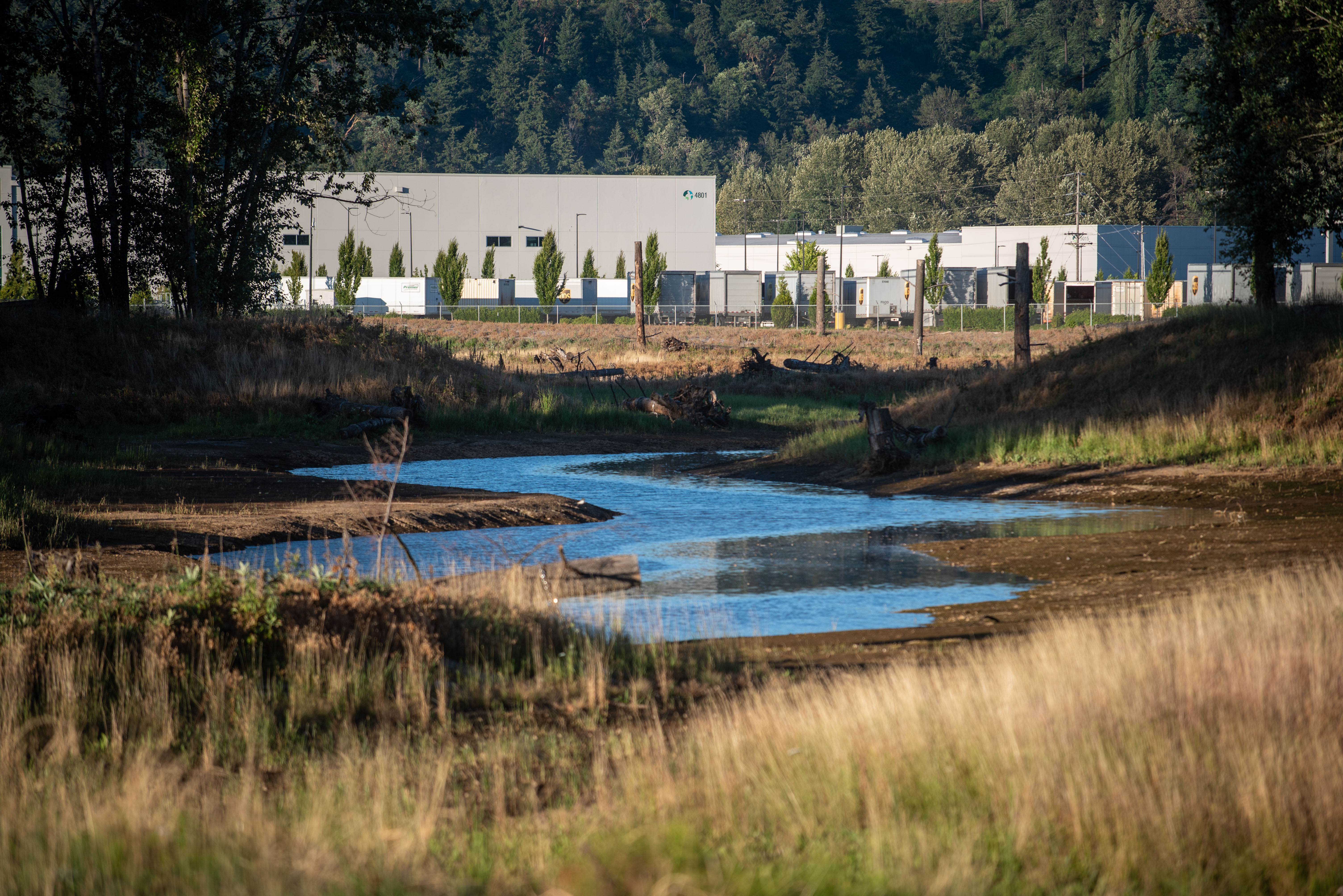
- Relocation of Wapato Creek from a ditched system to a longer, meandering stream channel and associated wetlands. This includes a variety of associated estuarine/freshwater habitats and a densely vegetated forested upland buffer to provide an increase in the quantity and quality of fish and wildlife habitat, wetlands, and flood capacity.
The Lower Wapato Creek Habitat is located at 1131 E Alexander Ave. in Tacoma (between 12th Street East and State Route 509 near Alexander Avenue).
The project re-establishes stream and wetland habitat on approximately 20 acres of tidally influenced estuary and fish bearing stream. This type of habitat is very limited within Commencement Bay and is a high priority for restoration. This project improves habitat on lower Wapato Creek and augments the PTOI’s fish and wetland habitat site constructed upstream near Freeman Road.
The Port coordinated all work with the PTOI and their Historic Preservation Office, conducted archeological monitoring, and implemented the project’s inadvertent discovery plan for encountered cultural resources. Three culturally modified trees and thirteen culturally significant trees (>48 inch in diameter) were unearthed during construction along with many other smaller trees.
The project design incorporates cultural and habitat conditions requested by the PTOI including protection of an existing large cottonwood tree with a hawk’s nest and preservation of as many mature trees as possible on the site, among other items. The discovered culturally modified and culturally significant trees remain on site in protected upland areas.
This project provides advance mitigation for future unavoidable wetland impacts on Port-owned properties and for non-endangered species act (non-ESA) fish/habitat impacts to Wapato Creek (downstream of the site).


Construction begins
Removing culverts at the Lower Wapato Creek Habitat Site
Supporting resources
Existing conditions

The 12th Street East culverts are partial fish barriers and impede fish passage on Wapato Creek. The historic meandering creek was ditched into a straight channel (in the mid-1960s) along 12th Street East and Alexander Avenue and currently has very limited fish habitat and no floodplain or wetlands. The site currently has numerous cottonwood and madrone trees and extensive invasive vegetation.
